2,269 total views
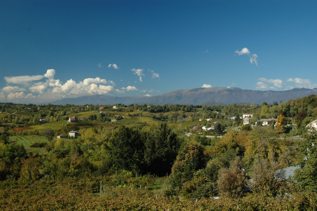
The Colline del Prosecco of Conegliano and Valdobbiadene, in the north-east of Italy, constitute a scenery dominated by hill ridges, ciglioni(small vineyards located over narrow grassy terraces), forests, villages and crops. Over the centuries this rugged terrain has been modeled and adpted by man and since the 17th century the use of the ciglioni has created a particular checkerboard landscape made by parallel and vertical rows based on the slope of the land. In the 19th century the vine-coltivation technique known as bellussera has contributed to develop the aesthetic features of the landscape.
The bellussera, invented by the Bellussi brothers to oppose the downy mildew in the late 19th century, involves a geometrical disposition of the vine plants accomplished through the use of rows of wooden poles 3 or 4 meters high, whose summits, joined with iron wire, cross making up a ray system. The vines that climb the poles are developed following the structure’s iron wires and form a vineyard that, from an aerial view, looks like a giant beehive, a nature’s geometrical embroidery, that outlines the territory in an almost abstract way. This ancient method is still used to this day for a viticulture made exclusively by hand.
The landscape’s mosaic appearance is the result of practices that are environmentally friendly and that make a virtuous use of the territory, today as in ancient times: the small vineyards on the ciglioni coexist with forest corners, small woods, hedges and rows of trees that are used for connecting the different habitats, the villages are scattered in the narrow valleys or perched on their top.
From the 7th of July 2019, theColline del Prosecco of Conegliano and Valdobbiadene have been included in the World Heritage List as cultural landscape, alongside the Amalfi Coast, the Cinque Terre, the Cilentano and the Diano Valley, the Sacri Monti, the Orcia Valley, the Medici’s villas and gardens, the vineyard landscapes of Langhe-Roero and Montferrat.


(Gabriele Castagnoli, 2020)

(Gabriele Castagnoli, 2020)

(Gabriele Castagnoli, 2020)

(Gabriele Castagnoli, 2020).